go-elbrus.com - Maps and satellite images of Mt. Elbrus and surroundings
| RU | EN | DE |
| news | programs & events | reference info | about us | contacts |
Maps, satellite images, GPS coordinates
Maps
Swiss Topo Map (1:50 000)
This new map of Elbrus and surroundings (1:50 000) was created by Swiss topographer Sandra Greulich with support of Liza Pahl/ go-elbrus. In German, English, Russian.

Mt. Elbrus and surroundings (Russian military maps 1:100 000)
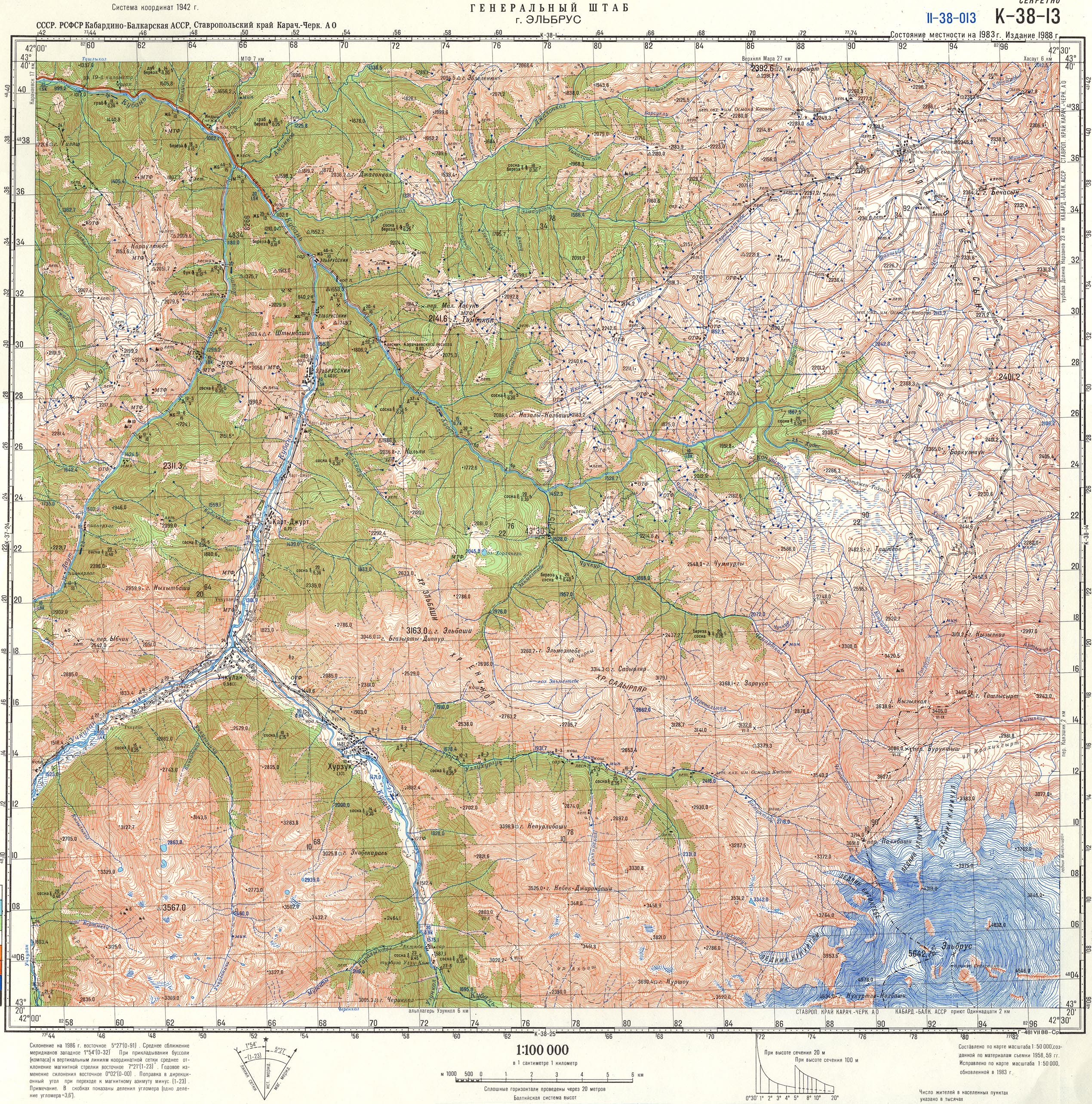
Sheet K-38-013.
North-Western environs of Mt. Elbrus.
(2500 x 2500 pix, 2.8 mb)
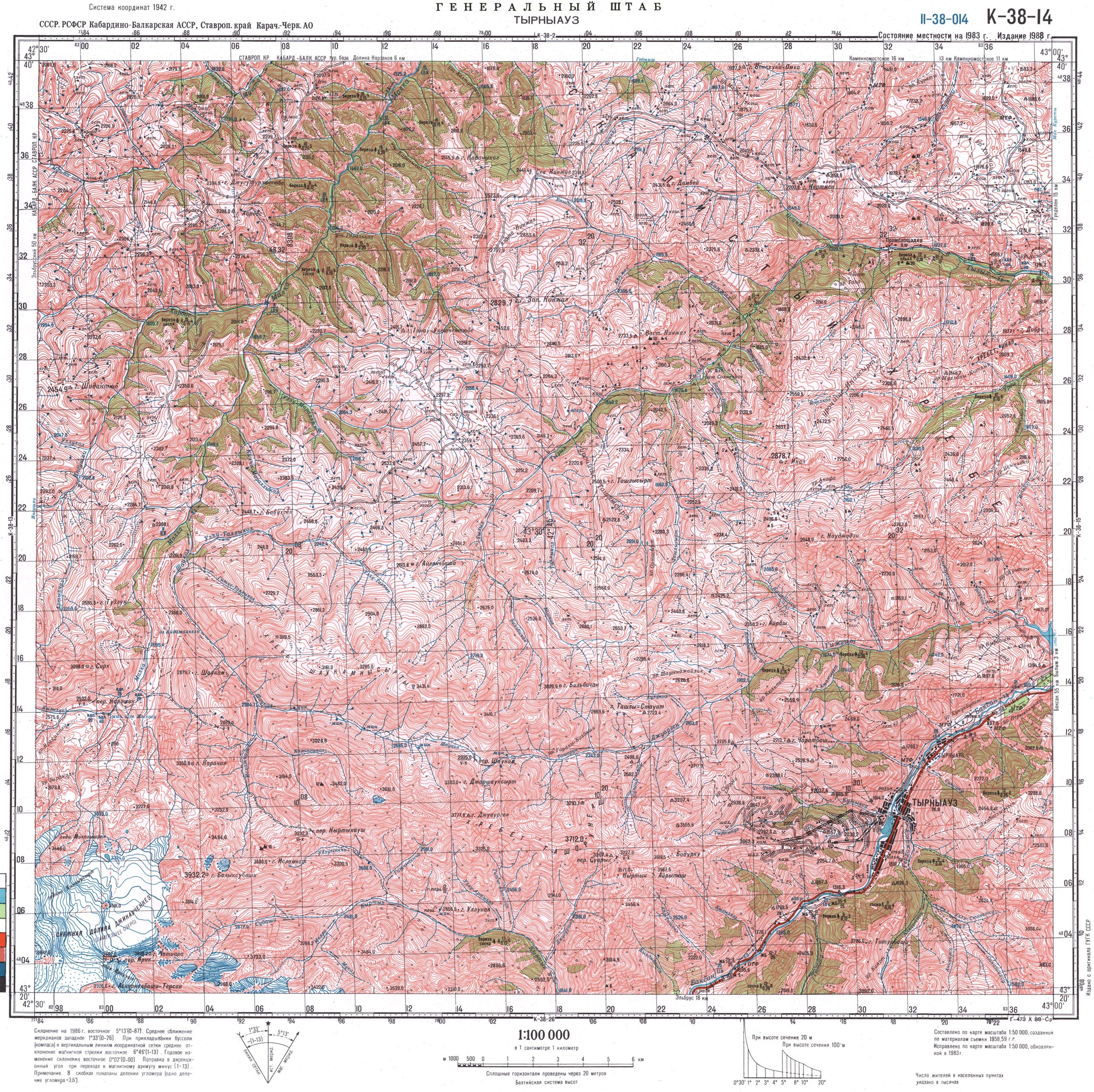
Sheet K-38-014.
Noth-Eastern environs of Mt. Elbrus.
(2500 x 2500 pix, 2.2 mb)
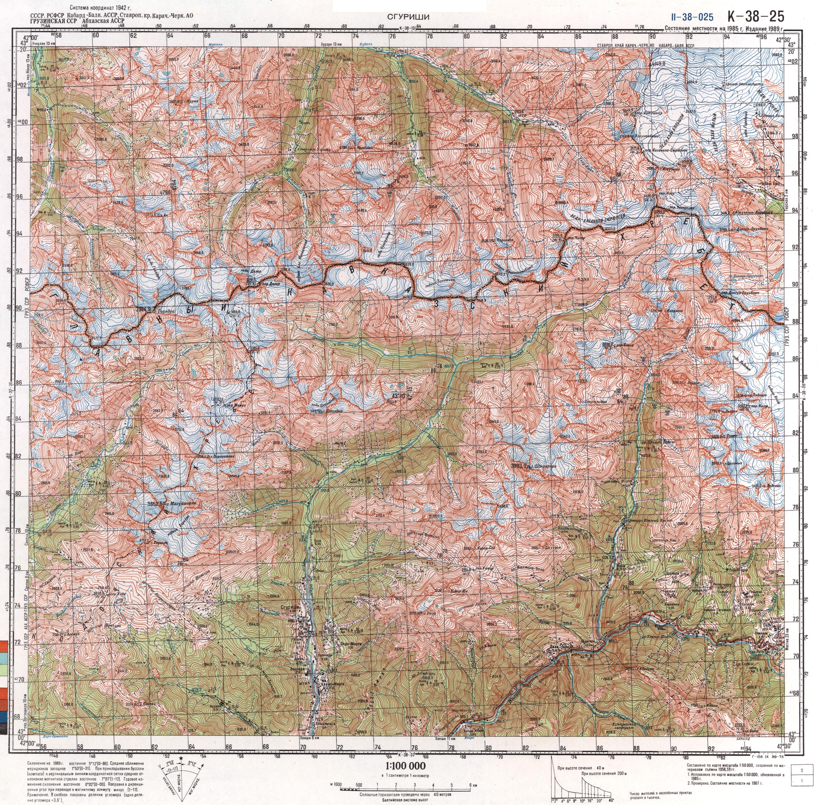
Sheet K-38-025.
South-Western environs of Mt. Elbrus.
(2500 x 2500 pix, 2.2 mb)
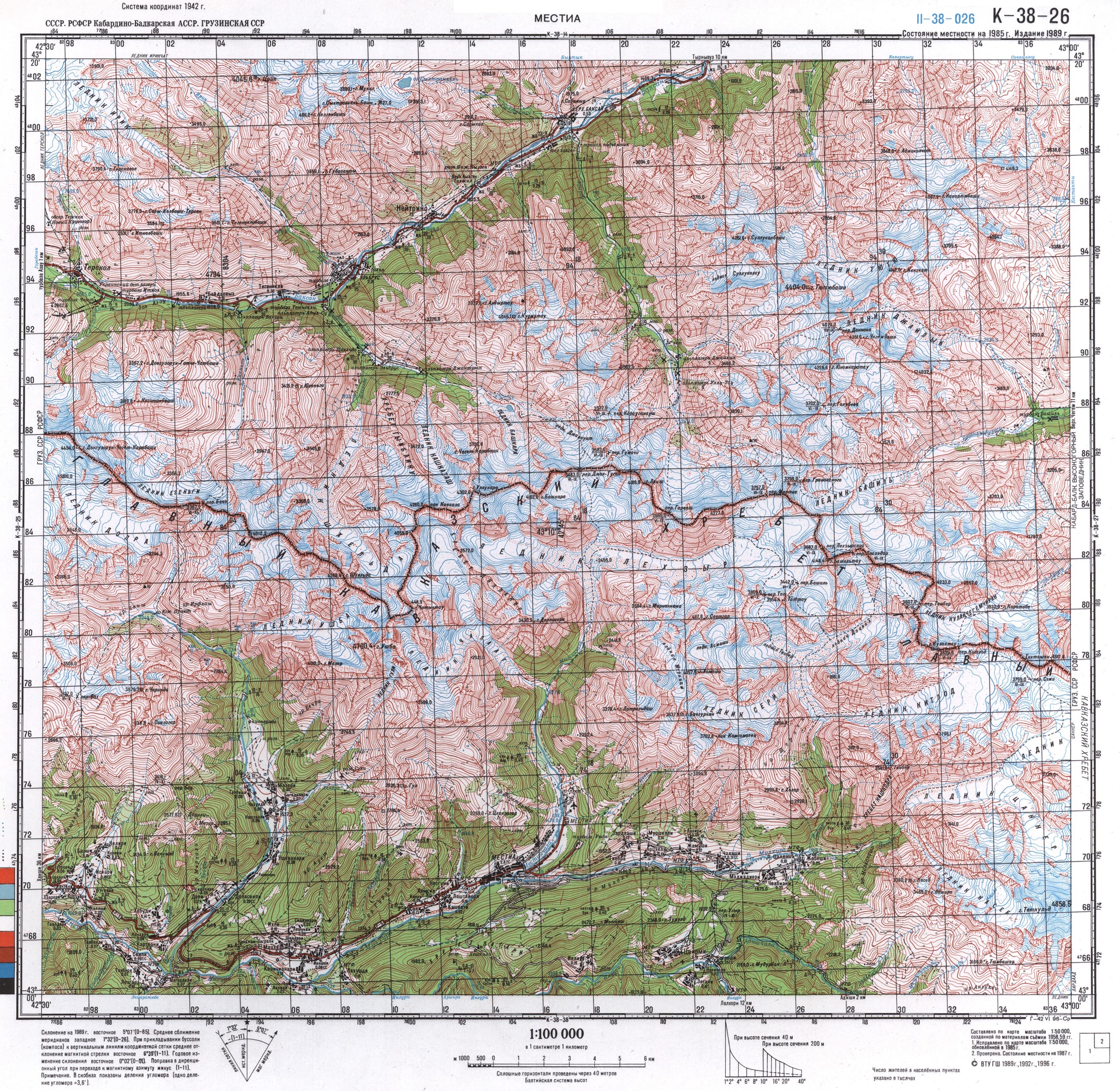
Sheet K-38-026.
South-Eastern environs of Mt. Elbrus.
(2500 x 2500 pix, 2.2 mb)
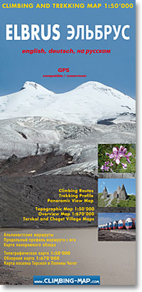
Mt. Elbrus (Tourist map 1:50 000)
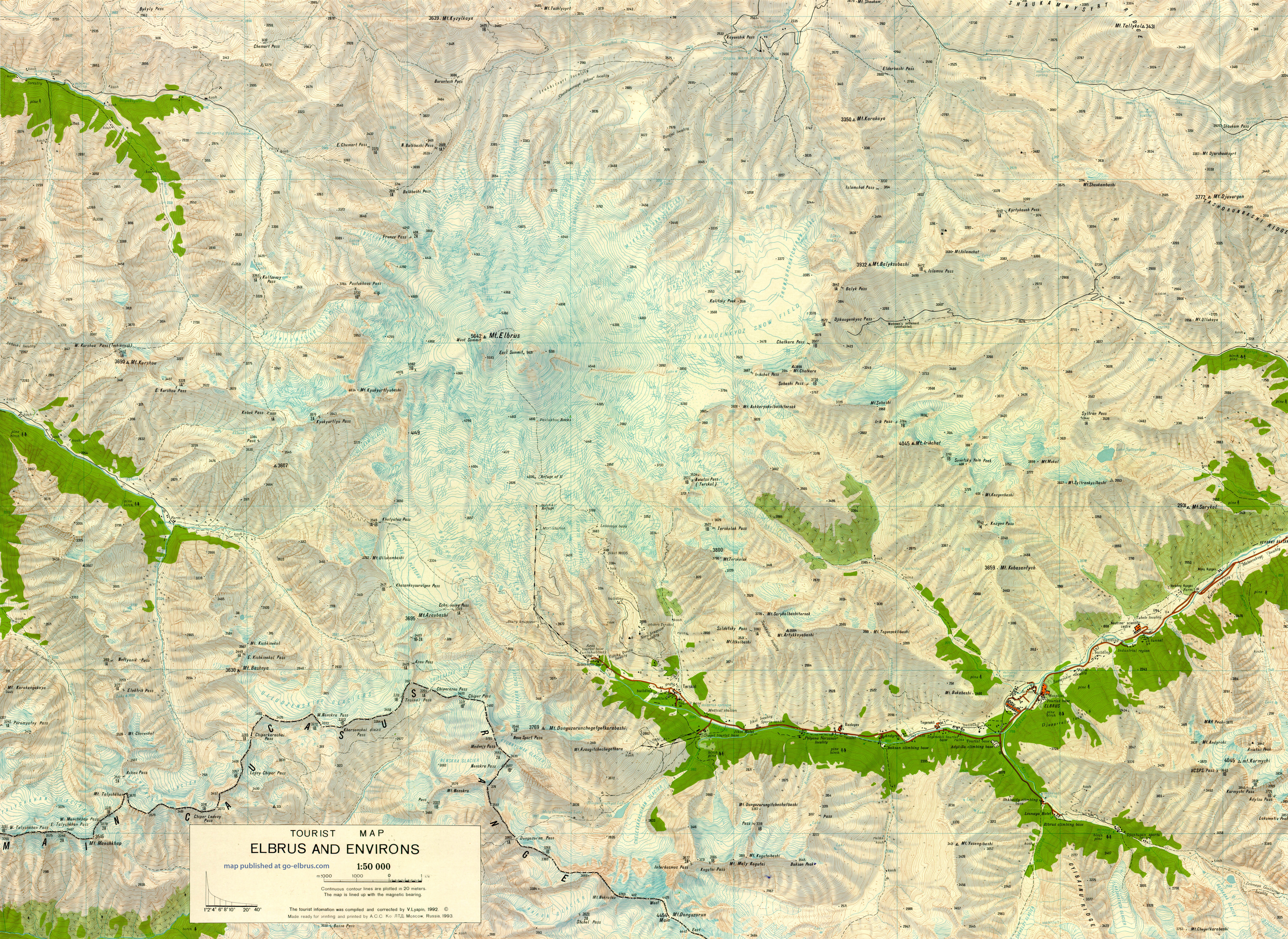
Map in English
(6200 x 4500 pix, 14.4 mb)
Mt. Elbrus (1:100 000)
Map in Russian
(2000 x 1800 pix, 2.2 mb)
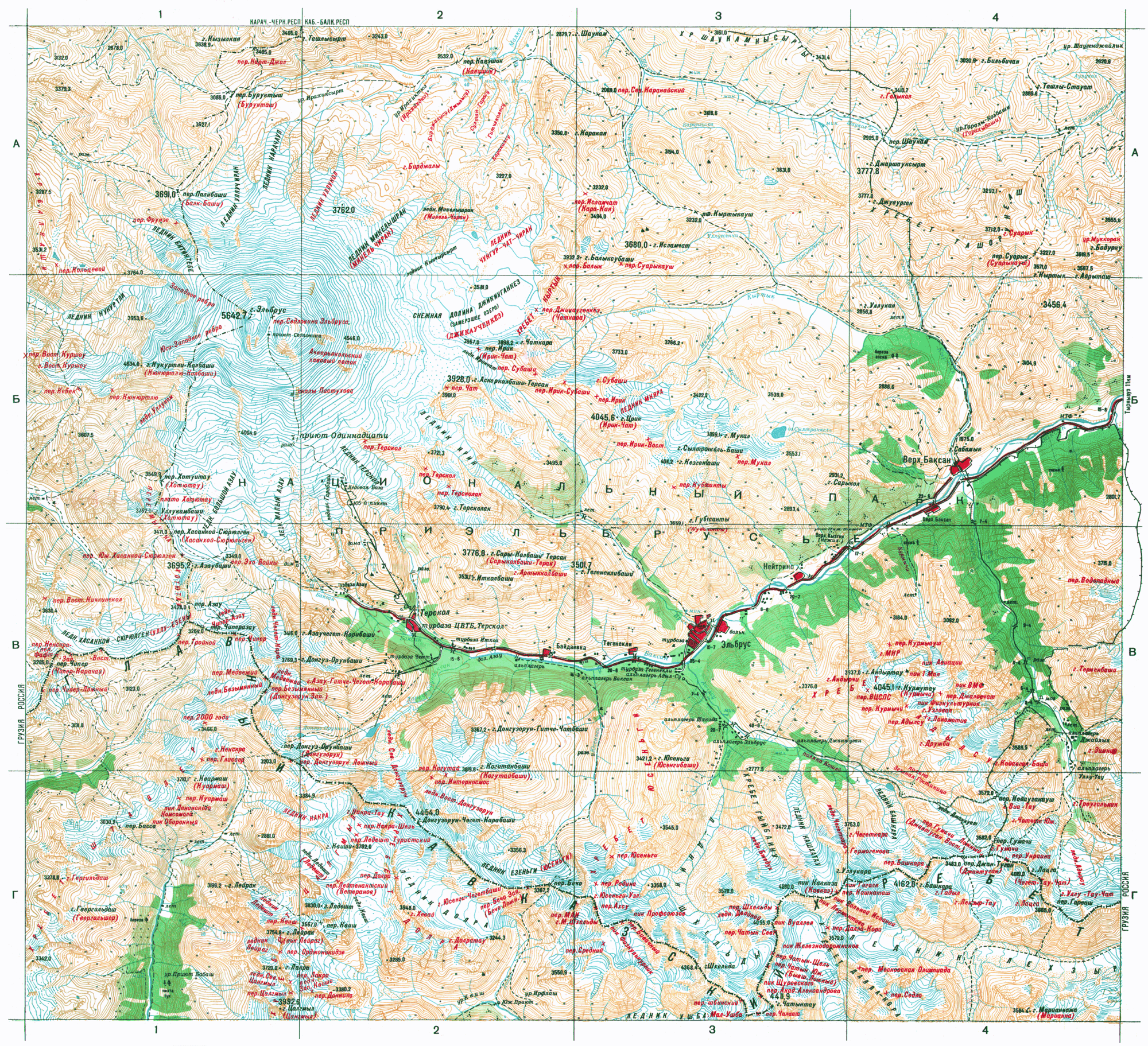
Mt. Elbrus (1:50 000)

Map in Russian and English
(2500 x 2300 pix, 1.4 mb)
Satellite images
Caucasus: General view
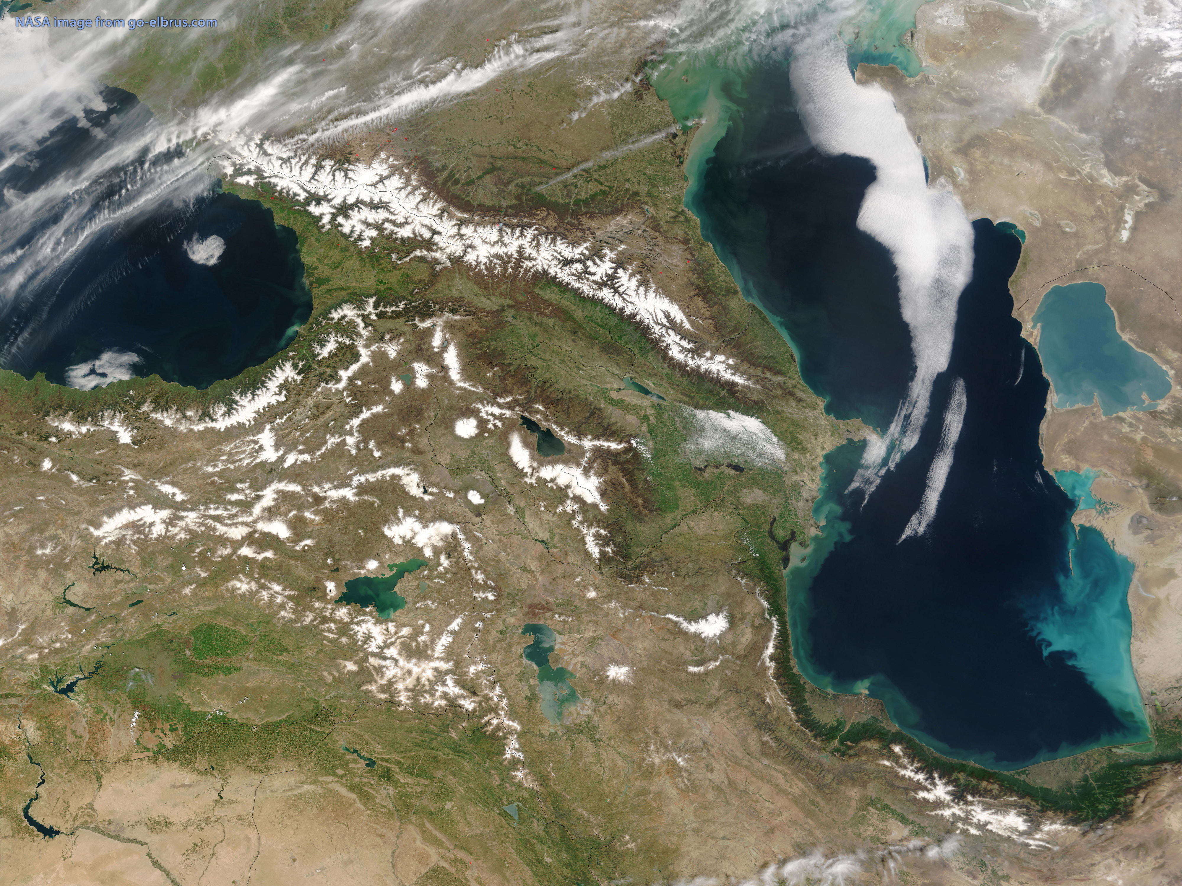
(4000 x 3000 pix, 3 mb)
Mt. Elbrus und Caucasus North and South of Mt. Elbrus
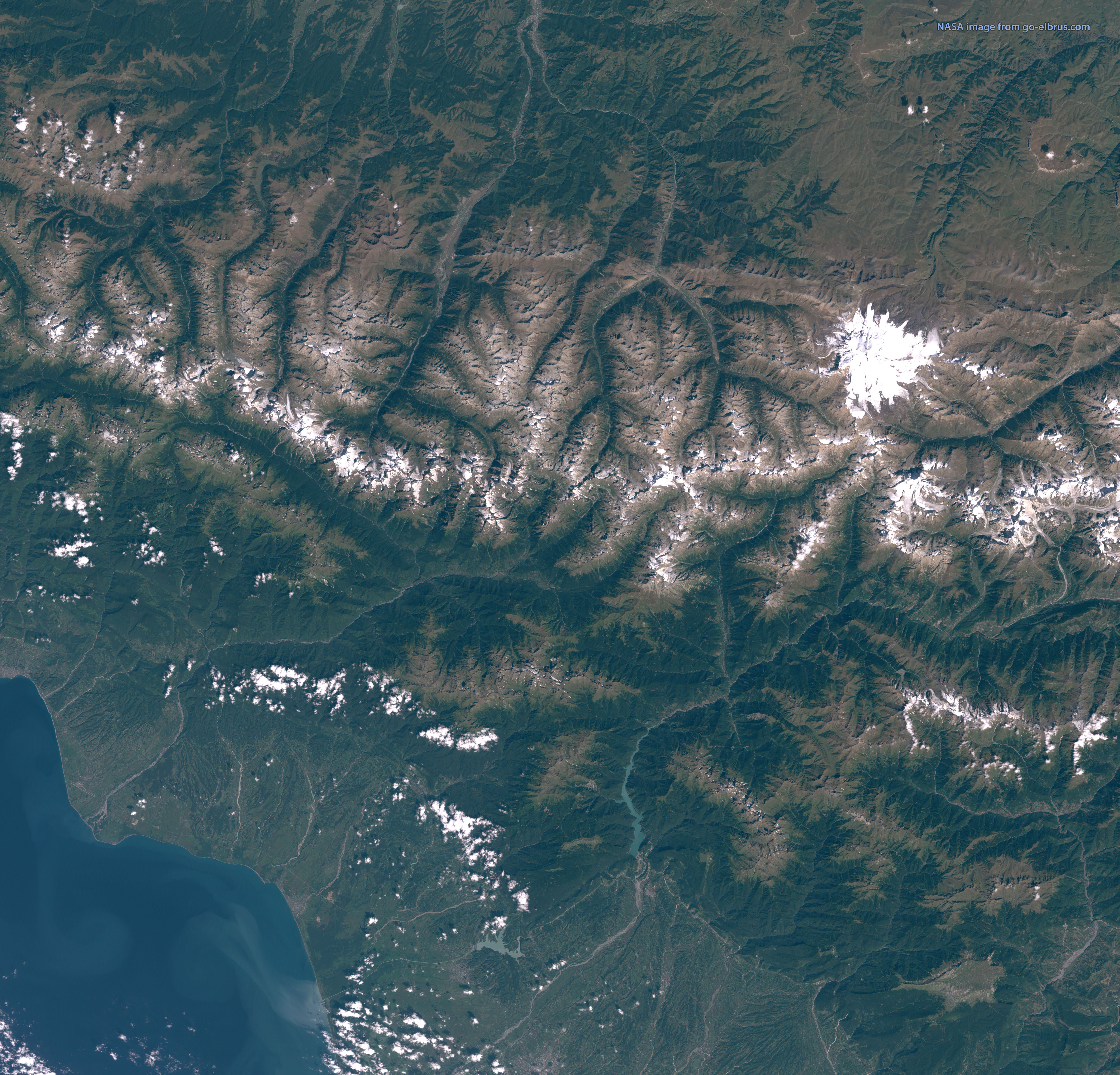
(5000 x 4800 pix, 4.7 mb)
Mt. Elbrus and surroundings

(3000 x 2000 pix 1.3 mb)
Mt. Elbrus
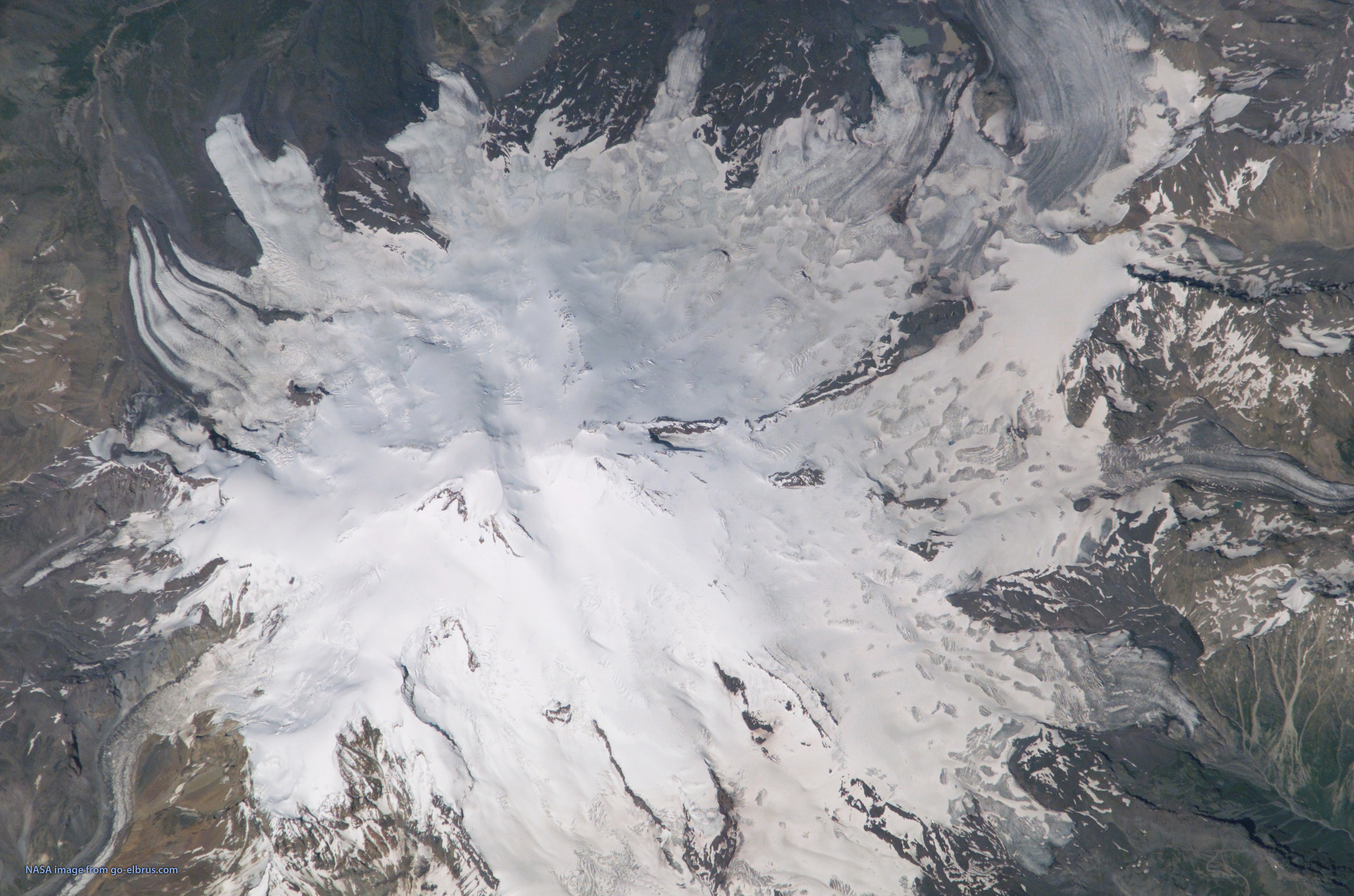
NASA satellite image
(3000 x 2000 pix, 1.5 mb)
Terskol village

Google maps satellite image
(2500 x 1400 pix, 1.2 mb)